Last Leg of the Ring Road Trip

A great many ‘tourists’ make the circuit of Iceland on the so-called ‘Ring Road’, aka Highway 1. Most do it as part of an iceland layover of 3 or 4 days or so; I have figured out the campgrounds to not begin to fill until very late evening and empty so early in the morning because everyone is trying to cover a lot of ground in a short period of time.

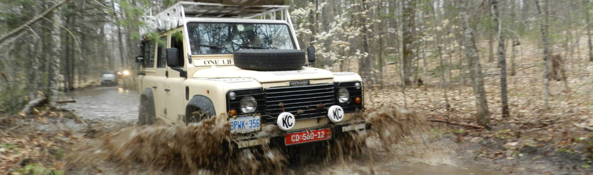
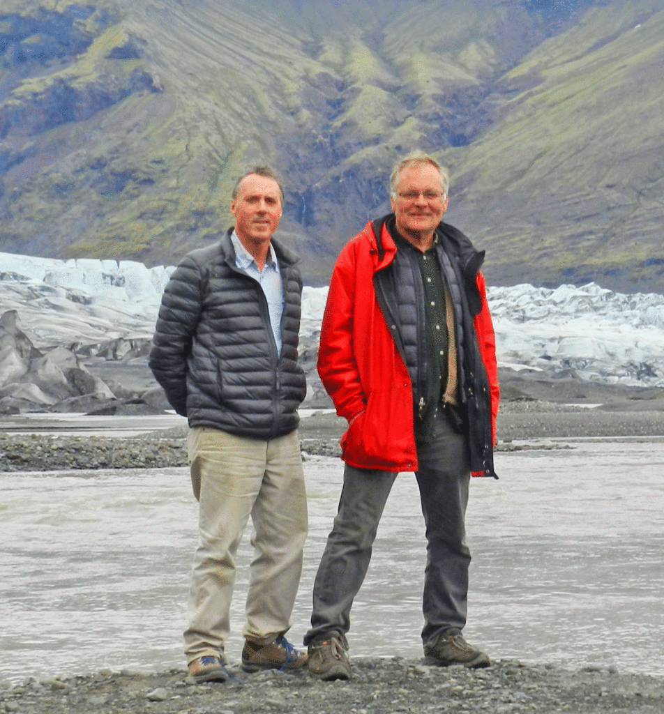
I was not so constrained. Maurice and I left Reykjavik on July 26 and were able to devote almost two weeks doing the so-called Golden Circle, a smallish area east of Reykjavik (see post by the same name) and also venture into the highlands to explore some remote northern corners of this beautiful country, something which few travellers, and even fewer tourists, are able to do. At the end of that first two weeks I was only at the east of Iceland, when Stephen arrived and it was August 21 before Stephen and I had completed our southern coast sojourn and had to get back into Reykjavik for his return (and Laura’s) arrival flight. Almost a month circumnavigating Iceland via the Ring Road and exploring the highlands.

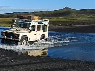
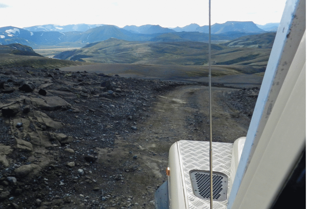
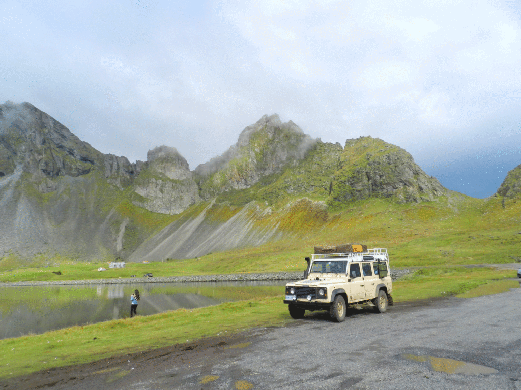
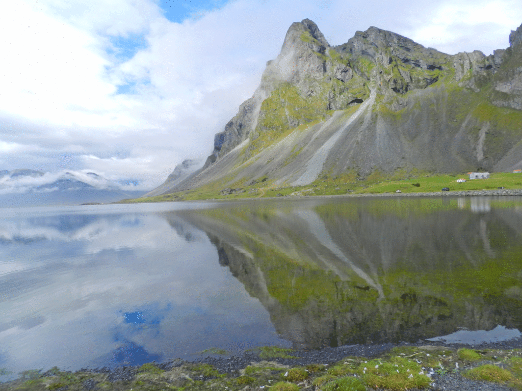
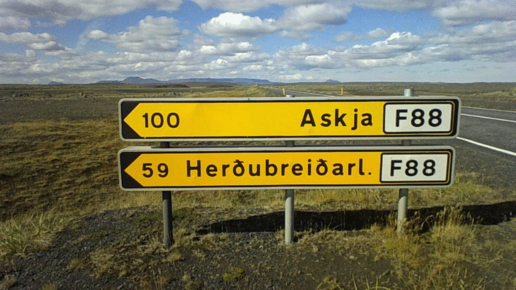
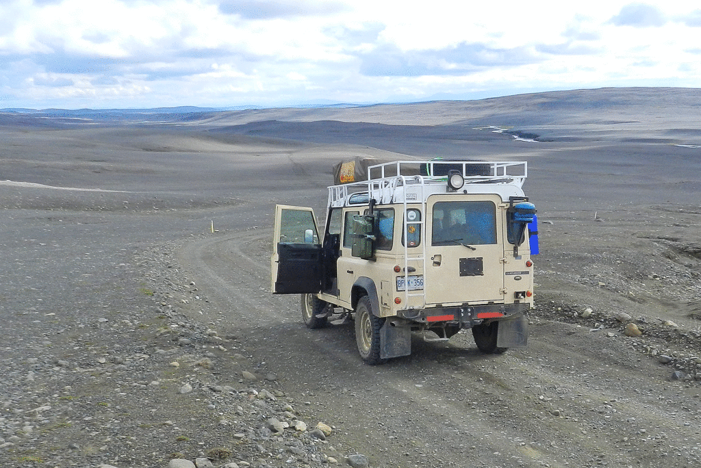
After leaving Landmannlauger (see previous post) Stephen and I had a very pleasant drive coming down from the highlands via the scenic F225. The F225 leads into the bottom (western) end of the F26 cross highland route (the long one that Maurice and I had eschewed in favour of the shorter F 35 for our south-north highland crossing a couple of weeks earlier. Shortly after Stephen and I joined the F26 it became the paved 26, which meandered through fields and sheep farms.

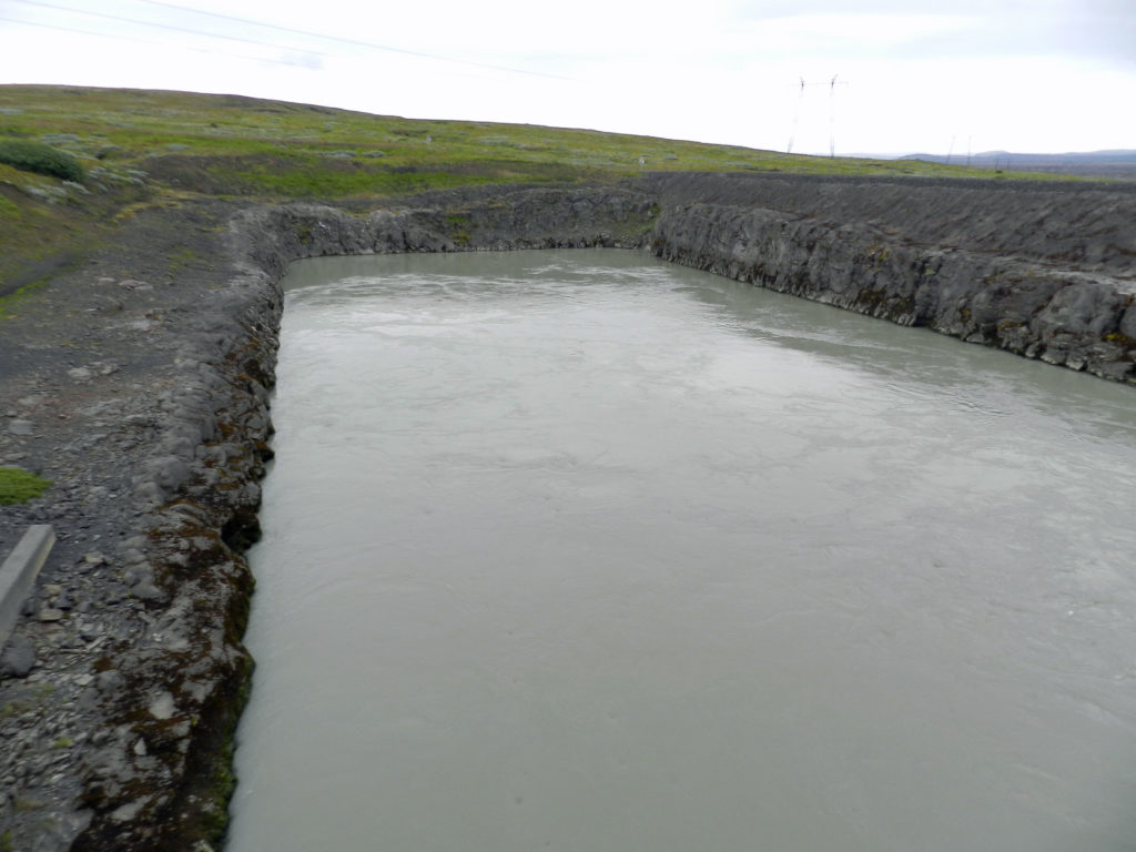
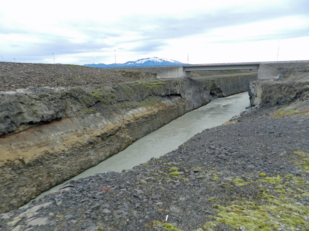
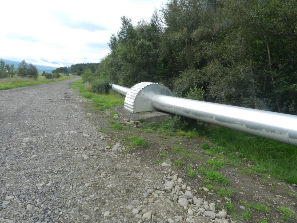
Along the way we came across a hydro installation unlike any I had ever seen before because there was no reservoir in the normal sense. My theory is that rather than flood a huge area they had tapped at least one and perhaps several points upstrean fed the water underground into not a reservoir, but rather into a seemingly very deep concrete pool that measured only about50 metres square adjacent to a dam. That then dropped the water through a penstock into a man-made trench below it. It was power-generating dam – a good 70% of Iceland’s electricity comes from hydro, geothermal accounts for almost 30%.

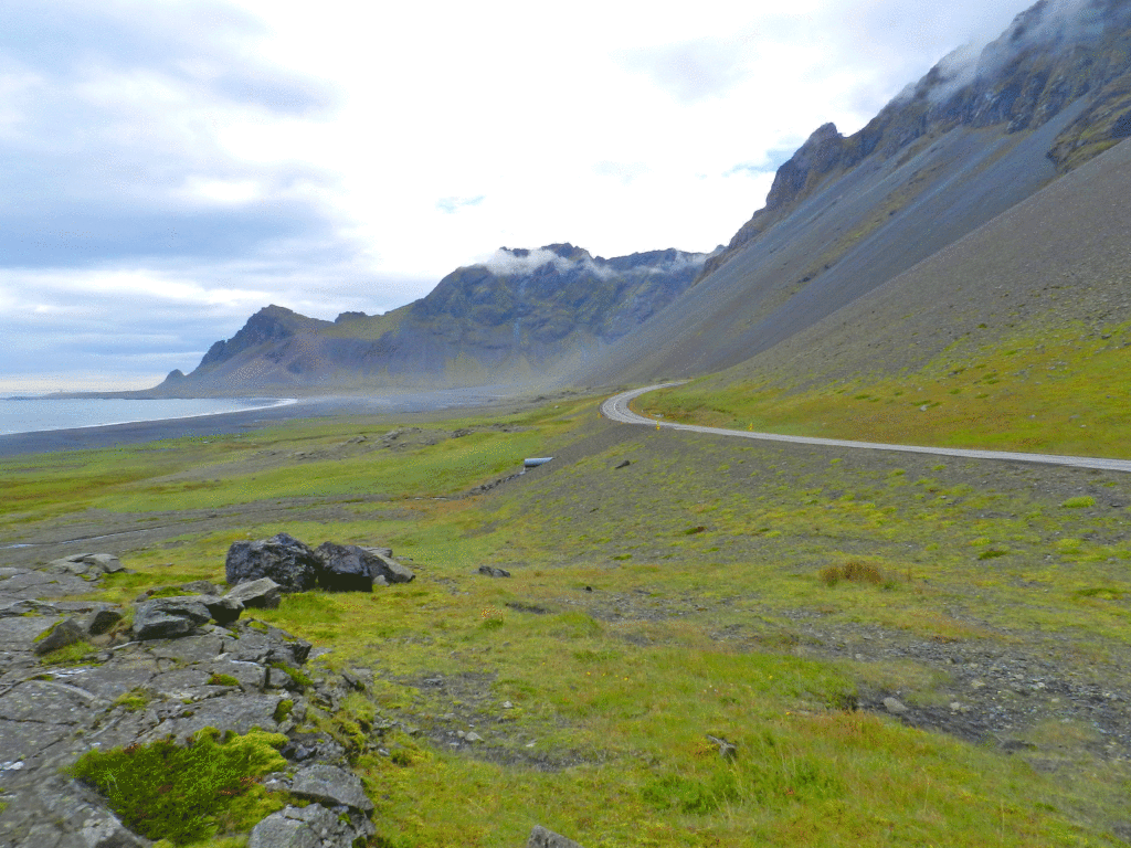
The 26 brought us back down to the Ring Road (Highway 1) which led us into Selfoss, a town of a few thousand located about 50 miles from the southwest coast by late afternoon. Its name notwithstanding the town has no waterfalls (‘foss’ means waterfall in Icelandic) ; it is a regional centre distinguished only as the site of the ‘Bobby Fischer Centre’ where the chess phenom’s grave is located. https://en.wikipedia.org/wiki/Bobby_Fischer

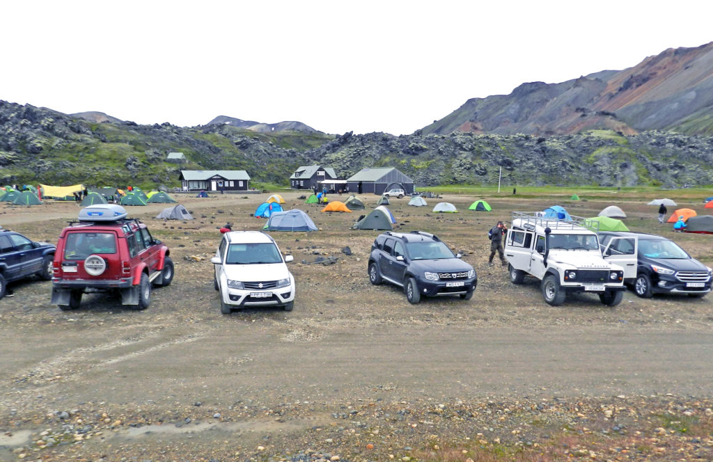
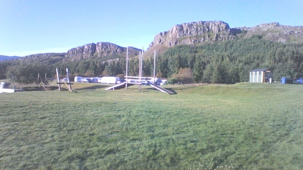
Camping Selfoss was our last campsite before Reykjavik https://www.gesthus.is/english/campsite/. It was a fascinating and busy place, with chalets, group camping, a field for individual camping. and a restaurant and separate self-serve hostel kitchen. I actually went back two weeks later with Laura and stayed in one of the bungalows. Unfortunately, when Stephen and I went there it was hard to enjoy the campground because it had been flooded and soaked by a week of very heavy rain. We were able to find a spot in the field to set up camp that was relatively dry . The restaurant was not available to us as a dinner option because it had been fully booked for a busload tour that was arriving shortly after we did, so Stephen and I opted to cook our own dinner out of the Defender. The rain had stopped, but it started again just as we were washing up and continued through the night. It was wet in the morning but it could have been worse – we had picked our spot well; by morning we were a bit of an island in a sea of water – getting to and from the washroom facilties in the morning was a very soggy trek.

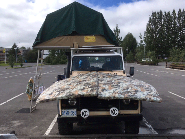
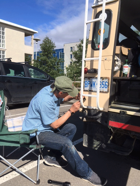
But I did acquire a couple of useful things from Camping Selfoss. Piled up against the outside wall of the communal kitchen was some steel tubing from a broken shelving unit that I thought might serve to repair the tent pole that I had managed to bend out of usefull shape while breaking camp a few days earlier. Incredibly, it turned out the scrap tubing fit very snugly inside the broken pole of the tent.- it is now stronger than ever. We also discovered a nice small aluminum camp table that had been left by a previous occupant of the site, it could have been there quite a while because it appeared to be just a cover for some infrasture in the ground. I just saw this 2 ft. piece of red on the ground and as I was examining it I discovered a very light and functional folding camp table which is now an integral part of the Defender kit.

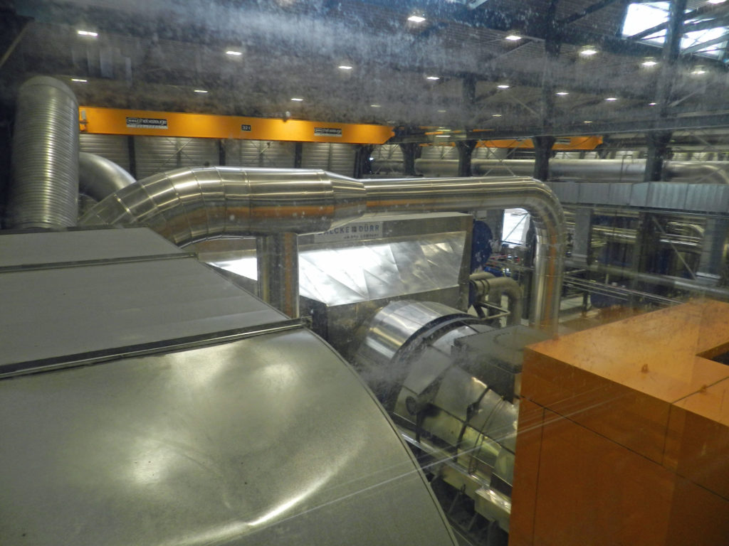
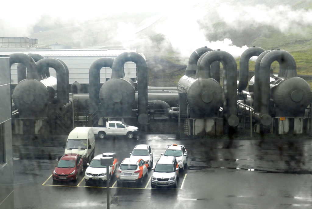
That day we resumed our return to Reykjavik, stopping along the was at a fascinating geothermal power info centre


Geothermal Power in Iceland

On the way back into Reykajavik from Selfoss Stephen and I stopped at the ON Geothermal Exhibit at Hellisheidarvirkju, which was certainly one of the most interesting and educational things I did in Iceland. https://www.tripadvisor.ca/Attraction_Review-g315849-d4358856-Reviews-Geothermal_Exhibition-Hveragerdi_South_Region.html

Hellisheidi power plant
Hellisheidi heat and power plant

Hellisheidarvirkjun (or Hellisheidi) heat and power plant constitutes the largest power station of Iceland and the second largest geothermal power station in the world.

Among the many interesting things we learned is that 26% of Iceland’s electricity comes from geothermal. There are many other uses for the water, including home heating, showers etc. ; it is also being distributed under the roads and sidewalks to melt the ice in the winter. Once used any non-consumed cool water is piped back to source and pumped back into the ground to maintain pressure of the geo-thermal sources for future use. Much of the geothermal water pumped from as deep as 2,000 metres (yes that is 2 km!) is too hot and acidic to be used in bathrooms, so that toxic water is used to heat clean surface or close-to-surface water which is safe to pump to Reykjavik for residential use.


Cross-section of pipe used to transport geothermal hot water
Typical geothemal hot water distribution in Iceland
Geothermal power turbines at Hellisheidi)
Geothermal tanks

Hellisheidi is only a couple of hours from the capital so it was an easy drive from there into Reykjavik from whence Stephen was leaving the next day on the same plane as Laura was arriving.

Landmannlauger

The opportunity for outdoor adventure is one of the big draws of Iceland, and no single outdoor adventure site is a bigger draw than Landmannlauger. Situated in the highlands a few hours drive from the south coast, its popularity is based on its combination of exotic remoteness and its relative accessibility compared to many other highland destinations. While it is technically located in the highlands, Landmannlauger is also not nearly as bleek as some of Iceland’s other highland areas that I visited (See post on F35), and features a hot spring set in a landscape of lava debris in an area that also has lots of green.

The approximately 4 hour drive in from the Ring Road coming from Vatnojokull did not disappoint.   It took us through a changing landscape that featured rocky outcrops and enough river crossings that I finally felt the investment in the snorkel was worth it.

On the F208 toward Landmannlaugar

We did not take enough photos of this beautiful stretch of highland road in so I, with credit where credit is due, I am going to use a video taken by another F208 user who captured the experience very nicely. It is a bit long, the latter half contains the more interesting country. Our weather was much better than depicted in this video.

At Landmannlauger itself we had to confront one of the more challenging stretches of the trip because it is preceded by a ford that can be relatively deep. Located a couple of hundred yards from the campsite many visitors who drive themselves in prefer to avoid crossing and park outside and use a pedestrian footbridge to go over the water and walk to the the campground . Just a hundred meters later, the campsite is the starting point for many hikes,to admire the mountains that dominate the site. Stephen and I drove in no problem.

Most visitors are there to hike. There is an established popular 4 day trek trail between Landmannalauger and Thorsmork to the west (see subsequent post of my visit there with Laura) and there are “buses” that make the trip to both ends of the trek on a daily basis. We could not tell if there was a particular preferred direction to make the hike; some of the hundred or so people camped there when we were there had just come off the trek from Thorsmork and some were just heading off in the other direction.
The campsite featured a large open camping area with couple of simple structures to provide showers and a covered eating areas and a more finished building contained dormitory facilities.

Upon checking in to pay for camping we were issued wrist bands just like the ones one gets at all-inclusive resorts in the Caribbean, but there was no free bar and indeed not very much in the way of facilities. The way it was managed reminded Stephen of refugee camps he had seen in Ethiopia; one could not use the bathrooms or enter the shower area unless you had one of those wrist bands. It was striking how all movements were controlled and managed. Icelanders are not the most welcoming of people.

And of course, Landmannlauger has a hot spring that feeds a natural pool, and we made the most of it. We were there in the early evening and there were only a few of us in there. I had a conversation with an English couple that owned horses at home and had spend some time riding the Icelandic horses. I learned that Icelandic horses are unique in many ways. The relatively small size is a feature I knew about, but apparently they also have a step that no other horses have. We spent a most pleasant quiet hour in the pool, and were pleases with our timing when later we were woken up in our tents by the crowd of late-arriving hikers that had descended s there towards midnight when it was dark.

Stephen and I in the Landmannlaugar hot spring. (who is that girl?)
Stephen soaking out the F208

In the morning when I climbed down from the tent Stephen was nowhere to be seen and it was an hour before he returned from a hike along the trail to Thorsmork. After a slow breakfast we hit the road, continuing along the F208 going west, with no real idea of what our destination was . That is actually a wonderful feeling, being in a strange place not sure where you are or where you are going. We had a very pleasant drive coming down from the highlands via the scenic F225, which leads into the bottom (western) end of the F26 cross highland route (the long one that Maurice and I had eschewed in favour of the shorter F 88 for our south-north highland crossing 3 weeks earlier. Shortly after Stephen and I joined it became the paved 26, which meandered through fields and sheep farms.


Vatnajokull Glacier

From the eastern Fjords Route 1 meanders along the southern coast through remarkable and changing landscapes, from steep rolling landscape to a vast flat area along the coast closer to the glacier, a creation of successive floods caused by sub-glacial volcanos that have erupted and sent acres of scree to the coast in the rushing melt-water.

Vatnajokull is not only Iceland’s largest glacier, it is the largest glacier in Europe. https://www.mountainguides.is/blog/vatnajokull-icelands-largest-glacier The glacier and the area around were only declared a National Park in 2008, but it attracts more visitors than any other spot in the country.

The vast majority of the glacier is in the highlands extending north from the coast, but it does descend almost to the ocean at a couple of points. At Jökulsárlón there is a glacial lagoon that has been growing for a few decades as the result of glacial melting. https://en.wikipedia.org/wiki/J%C3%B6kuls%C3%A1rl%C3%B3n Our stop there was rendered brief by a cold, driving rainstorm but we were able to get a couple of pictures at least.


Jökulsárlón

The Park’s main visitor centre and campground is at Skaftafell. By the time we got there the weather was better and we were able to do a short trail up to the glacier itself.

Stephen and I at Vatnajokull near Skaftafell

We opted not to stay at the Skaftafell campground because it was, as we had expected, quite crowded. Instead we continued west to a private, very well-run campground. There we met a Brit in a Defender that had come down from Landmannlauger, the highland hiking area which was our next destination. He made a very enthusiastic recommendation of an F-Road going in to Landmannlauger, the F-208. He said it had many water crossing but nothing a Defender could not handle. This proved to be one of the nicest overland routes I did in Iceland (not the nicest – that distinction belongs to the Thorsmork trip that I did later with Laura). Landmannlauger is the subject of the next post.

The Eastern Fjords

From Eglisstadir we headed south to an area known for the long finger like penninsulas that create deep fjords. With the exception of one recently-created short-cut the R1 route follows the ocean in and out of each fjord. Lots of distance, but the landscape is fantastically beautiful. More mountainous and rockier than the north, with scree littering the steep slopes. I told Stephen he and I should agree not to show any of our photos to Maurice. For this leg of the trip the weather was also very good. A bit cool but sunny enough that the colour of the green moss landscape really shone through.

Stephen in the Eastern Fjords

Our destination that night was Berunes Farm. Situated on one of the fjords it advertised an inn and campground and marked the approximate halfway point between Eglisstadir and the Skaftafell National Park https://www.east.is/en/what-to-see-and-do/services/berunes-hi-hostel

Berunes Farm

The campground was not spectacular, just a soggy field surrounded by a few bushes, but the location up from the fjord was lovely, and they had a cozy bar in one of the buildings on site. We cooked our own dinner and then retreated to the bar for a nightcap. The spot next to us in the camping field was occupied by a small camper truck that had been rented by 3 Australian women – Stephen and I could not at all figure out how the three of them all fit to sleep inside the camper. They were travelling in the opposite direction than we were and were able to foreshadow the Vatnojokull glacier that lay ahead of us, complete with stories of how they had taken some ice to use in their vodka.

I head East to Eglisstadir and Stephen Joins In

After Maurice flew out of Akureyri to return to Canada on August 10 I had a couple of days on my own before I had to be in Eglisstadir, Icelands eastern provincial centre, to pick up my friend Stephen at the airport there. Before I headed east I had some time to visit a couple of museums in Akureyri and to participate in the Dalvik fish festival (described here ).

The drive from Akureyri to Eglistaddir is along the Route 1 two lane paved highway and only takes about 3 hours.

En route I came across the access point to the F88 highland road https://www.dangerousroads.org/europe/iceland/570-askja-road-iceland.html that leads, after some 100 long and rough kilometres, to within hiking distance to the Askja volcano, one of Icelands outstanding features. I was alone so could not contemplate doing that trip even if I had had the 2 or 3 days I would have needed. All the same I could not resist spending an hour or two cruising up the F88 until I was convinced that it was indeed very rough – lava field washboard/corduroy rough. But even with that, and even being alone, with no time, it was really hard to turn around. There was something about that stark landscape with the volcano visible on the horizon that was very seductive.

I got back on the Route 1 and continued my descent to Eglisstadir in the east, following quite a lovely valley lined with smalll waterfalls. Eglisstadir is a small city a few miles inland from the east coast and has a small airport where I was to collect my friend Stephen early the next afternoon. I did not spend too much time in the town itself, but headed south in search of the Hallormsstadur Forestry Reserve, which has a campground. Forests are definitely NOT a defining feature of Iceland, but this one was quite impressive. http://www.visitegilsstadir.is/en/things-to-see/hallormsstadur-national- I stayed in Atlavik campground, in a beautiful tree bound site near the shores of Lake Lagarfljot. The weather was warm, bright and beautiful…..I wish I had thought to take some pictures to prove it.

Stephen was due in early afternoon the next day and in the morning I got up early enough for a good 3 hour hike up to a viewpoint looking down on the lake before driving back up the lake to Eglisstadir. I was rather expecting Stephen to be tired when he got off the plane because he had flown overnight from Canada before connecting to the domestic Reykjavik-Eglisstadir flight that morning. I scouted out a hotel I could take him to and was rather looking forward to a good nap myself, but to my surprise he arrived ready to explore. On his suggestion we drove out to Seyðisfjörður, a port located in a fjord which required driving over a high headland where fog and rain were thick.

Seyðisfjörður

Seyðisfjörður is where a weekly ferry lands from Denmark via the Faroe Islands and is where many Europeans with their own vehicle come in, so there were lots of Defenders and other 4x4s around that had explored Iceland and were waiting to board the ferry the next day. Seyðisfjörður is also where the dark Icelandic crime film ‘Trapped’ was set, in which the ferry plays a central role.

Stephen and I had tea in a charming little shop before we headed back up the road to Eglisstadir. Stephen liked the idea of the forest so we eschewed the hotel idea and instead went back up the lake to the Atlavik campground where I had spend the previous night. The weather was great and we enoyed a restful night getting ready for the next leg of the journey: the eastern fjords

Great Waterfalls and Terrible Weather – Maurice Heads Home

Aspyrgi is a national park located in northern Iceland east of Lake Myvatn. It is actually the northern section of Vatnajökull National Park that runs from the glacier of the same name in the south almost all the way across the country. It is also the location of Dettifoss waterfall, the most powerful in Europe.

From Dettifoss we continued north to to find the campground in Aspyrgi Park. This one was lovely, much more reminiscent of Canadian campgrounds with lots of trees. It was as natural and uncrowded as any campground I had been in Iceland to that point (although later in the trip I visited others that were also very good). We arrived at the end of a long holdiday weekend and there were were lots of Icelandic families about. It was still staying light until close to midnight at that point and and we fell asleep listening to the sounds of children cavourting on the play structures well into the night. We decided to stay in Aspyrgi a second night to be able to enjoy some hiking in the area. When we returned to the campground the second night after our hike there were two significant changes: there were few other campers as the weekend was over and all the Icelanders had gone back to work; and the weather had taken quite a turn for the worst, with temperatures near 5 deg. Cel. and lots of wind and rain.

This was a really tough point in the trip, we were completely bowed by the cold, wet weather and the

When the going gets tough…..with some camping staples at Aspyrgi

morning of our second day at Aspyrgi was miserable. It had rained all night and it was still only about 5 degrees C. We both recognized we were at the end of our camping tether and that we would need to seek proper shelter. Everything we had was wet; fortunately the washroom building in the campground had an amazing “dryer” comprised of a big closet with a couple of blowers that circulated warm air through the multi-layered hanging system. We used that system, which I had never seen before, to dry not only our sleeping bags and clothes, but also the Eureka tent that Maurice was using.

After packing up we drove straight to Husavik, a town in a nearby bay known for great whalewatching but we were not in the market for whalewatching, we just wanted to get warm. We went to the first hotel we could find only to learn that it was full, but the receptionist took pity on us (we were pretty pitiful at that point) and referred us to a friend who operated a guesthouse. It turned out to be a great spot. A large, quite recently constructed house with several sleeping rooms and a large, well-equipped shared kitchen. Maurice and I arrived mid-afternoon (it was still raining hard) before anyone else and had the run of the kitchen. We used just about every burner on the stove to create a wonderful dinner that featured a great lamb stew. After a couple of weeks of camping in occasionally very adverse conditions it was a luxury to enjoy ourselves out of the cold wind and rain. I really needed that.
We were now approaching the end of Maurice’s explorations of Iceland, as he had to catch his plane out of Akureyri in a couple of days. On our way back to Akureyri we stopped at another incredible waterfall, Godafoss.

Godafoss

When we got to Akureyri the weather was still iffy enough and we were still not quite fully recovered from our last camping outing so we decided to pass on the campground we had used on the way out and instead went to a real hotel. The Hotel Edda is an Icelandic chain of simple, yet very clean and comfortable dorm style accommodations that grew out of a practice that developed in Iceland in the 1950s of converting student dorms to summer accommodation for the then emerging domestic tourist industry. www.https://www.hoteledda.is/en/hotels/hotel-edda-akureyri  Of course no sooner had we settled in and the weather immediately improved, which allowed us to spend our last free day before Maurice left drying out our gear, specifically the rooftop tent and mattress, and doing some small repairs on the Defender.

Airing out tent and mattress in the Akureyri Edda hotel parking lot (maybe I could adapt this to reduce the Defender engine noise 😉
A rusted signal light needed a fussy ‘McGyvor’ fix. Note the blue sky and short sleeves

It was tough bidding farewell to Maurice, who had been there from the very beginning to help get everything organized and ready to go. Now I would be on my own for a few days as I continued to make my way east towards Eglisstadir to pick up Stephen, the next joiner.

Akureyri

Akureyri, the ‘Capital of the North’ and Iceland’s second largest city, is quite a pleasant spot to visit. The Hof Culture House (pictured above) is a theatre, gift shop and art gallery and the site of various events.

Set along the water at the head of a fjord, the town features some lovely residential streets and has a number of interesting museums, including separate museums devoted to Aviation, Industry, Toys, Motorcycles and Culture. I particularly enjoyed the latter, which provided a great overview of Icelandic residential architecture from its ‘functionalism’ roots.

Like in Reykjavik the campground was located right in town next door to the municipal pool.  The campground was rather crowded so we slipped over to the pool to check out it out. This was a great facility, with one large swimming pool and a number of smaller sitting pools of varying temperatures, even a steam bath. There were lounge chairs and although it was early evening the sun was still high enough to make it possible to enjoy some solar warmth. It was a family facililty with lots of things for kids, including a range of water slide options.

Hamrar Campground south of Akureyri

It was at the reception here I learned that a number of people were coming to the region to attend the ‘Fish Festival’ (“it might be a bit crowded tonight” and it was). The festival was taking place the next day in Dalvik, about 30 km up the fjord north of Akureyri. Not one to pass up a local festival that is how I spent my first solo day in Iceland after Maurice left. As the late morning traffic along the two lane paved road along the fjord leading to Dalvik became bumper to bumper and slowed to a crawl 4 km short of the “village” I realized this was a big event and that parking was going to be a real issue. When I got within walking distance I just put the Defender in 4WD and pulled off the road into the ditch. No one seemed to mind, there were cars everywhere. As I walked the kilometre or so into town I could see that many people had decorated their properties for the occasion with a fish theme, and many had rented space to RVs, tightly squeezed into peoples yards.

Decorated house in Dalvik

There were thousands of people from all over Iceland with a few international tourists mixed in. As they reached the large open space of what appeared to be a fish plant people joined any one of a 1/2 dozen lines to get free helpings of arctic char and cod hot off the barbie. The lines got shorter as the day wore on and the fish kept coming – I ate more arctic char in that single day, all for free, than I have in my whole life.

Live Music ranged from folk trios like this to a choir of fishermen.
Icelanders enjoying the music…..
……and the fish of course

After our first visit to Akureyri Maurice and I first headed back into the highlands


Saying Thank You to Opere, Paani and the boys

The eighteen months of our Land Rover restoration project brought us into contact with many people who in their own way contributed to the successful outcome.  We met mechanics and electricians, welders and painters, upholsterers and air conditioning specialists.   After returning from our trip one of our last Saturday afternoons in Ghana before departing for Canada was spent saying thanks to many of those individuals by inviting them to Opere’s shop for pizza and beer.  We set up the Defender in full campsite mode, filled the fridge with beer and soft drinks and brought some pizza from Frankies and meat pies we bought from Rejoice at the High Commission.

The turn out was not bad, if devoid of female presence.  Despite that, on request we put an Ebo Taylor CD in the stereo and the boys even danced.

It was our way of saying thank you and farewell to some people who helped  realize a project that was, when you think about it, rather unlikely and against the odds.

West Africa Wander By the Numbers


This is a very delayed post, sent almost three weeks after we returned to Accra and concluded our overland trip.

Here is a summary of our overland trip in a 17 year old Land Rover Defender, quantitatively speaking:

Countries visited  4

Kilometres driven  5,500

Km on unpaved  roads, ranging from reasonably good laterite to downright poor donkey track:  About 1,000

Oil consumed  ½ litre

Breakdowns:  0

Number of times stuck:  0

Maintenance stops 3

Flat tires:  1

Nights: 30

Nights camped in organized establishments 17

Nights bush camping 4

Number of campsites  16

Nights in hotels:  9

Number of hotels 5

Per night Cost  of Camping  $10

Per night cost of hotels $80

Most expensive night:  $110

Least expensive night:  $0

Days of rain:  3

Restaurant meals: 20

Camp/Picnic  Meals 70

Border crossings: 6

Currencies:  2

Blog posts published 25 (including this one)

Guides Hired:  11

And this is where we went:

Our counter clockwise route from Accra, Ghana, into Togo and Benin, back into Togo from northrn Benin, returning to Benin, on to Burkina Faso and back into northern Ghana descending to Accra. Red x”s indicate stopover points.