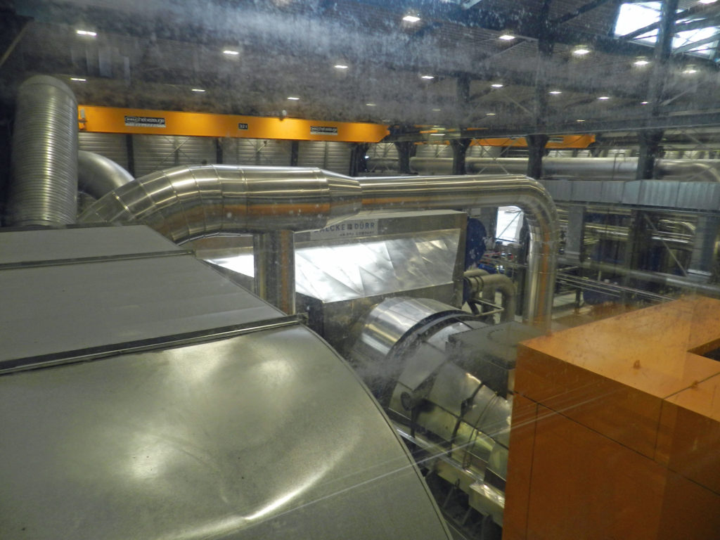
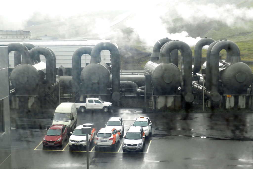
Hellisheidarvirkjun (or Hellisheidi) heat and power plant constitutes the largest power station of Iceland and the second largest geothermal power station in the world.
Among the many interesting things we learned is that 26% of Iceland’s electricity comes from geothermal. There are many other uses for the water, including home heating, showers etc. ; it is also being distributed under the roads and sidewalks to melt the ice in the winter. Once used any non-consumed cool water is piped back to source and pumped back into the ground to maintain pressure of the geo-thermal sources for future use. Much of the geothermal water pumped from as deep as 2,000 metres (yes that is 2 km!) is too hot and acidic to be used in bathrooms, so that toxic water is used to heat clean surface or close-to-surface water which is safe to pump to Reykjavik for residential use.
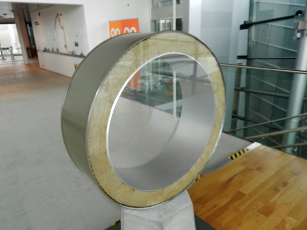
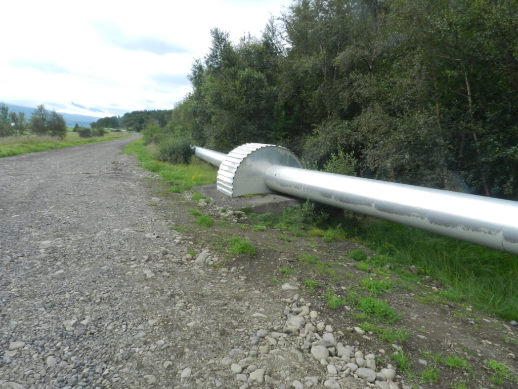
Cross-section of pipe used to transport geothermal hot waterTypical geothemal hot water distribution in Iceland Geothermal power turbines at Hellisheidi) Geothermal tanks
Hellisheidi is only a couple of hours from the capital so it was an easy drive from there into Reykjavik from whence Stephen was leaving the next day on the same plane as Laura was arriving.
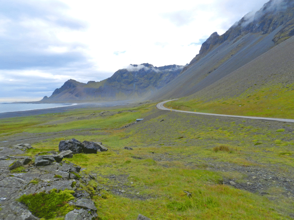
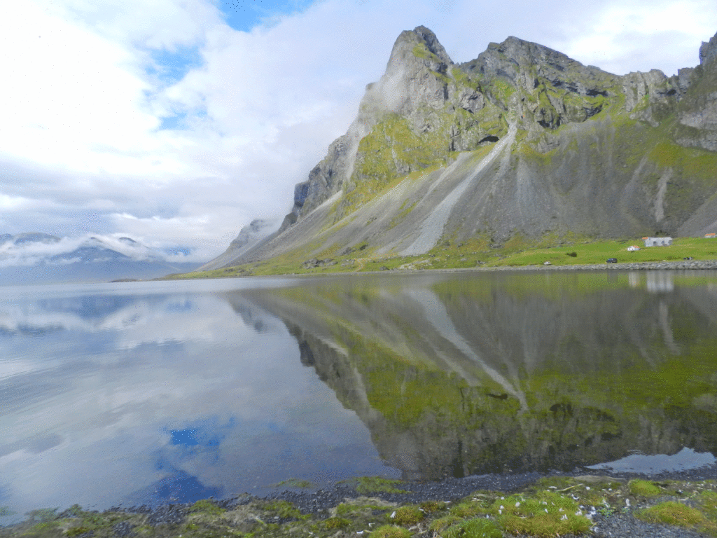
From the eastern Fjords Route 1 meanders along the southern coast through remarkable and changing landscapes, from steep rolling landscape to a vast flat area along the coast closer to the glacier, a creation of successive floods caused by sub-glacial volcanos that have erupted and sent acres of scree to the coast in the rushing melt-water.
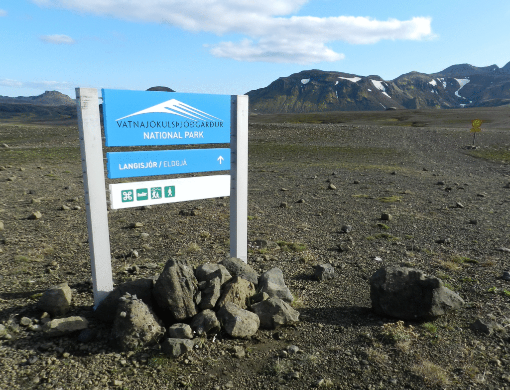
Vatnajokull is not only Iceland’s largest glacier, it is the largest glacier in Europe. https://www.mountainguides.is/blog/vatnajokull-icelands-largest-glacier The glacier and the area around were only declared a National Park in 2008, but it attracts more visitors than any other spot in the country.
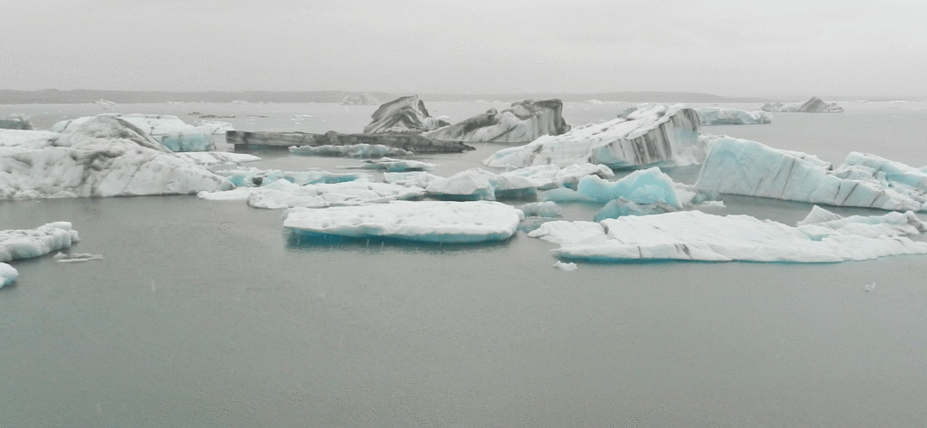
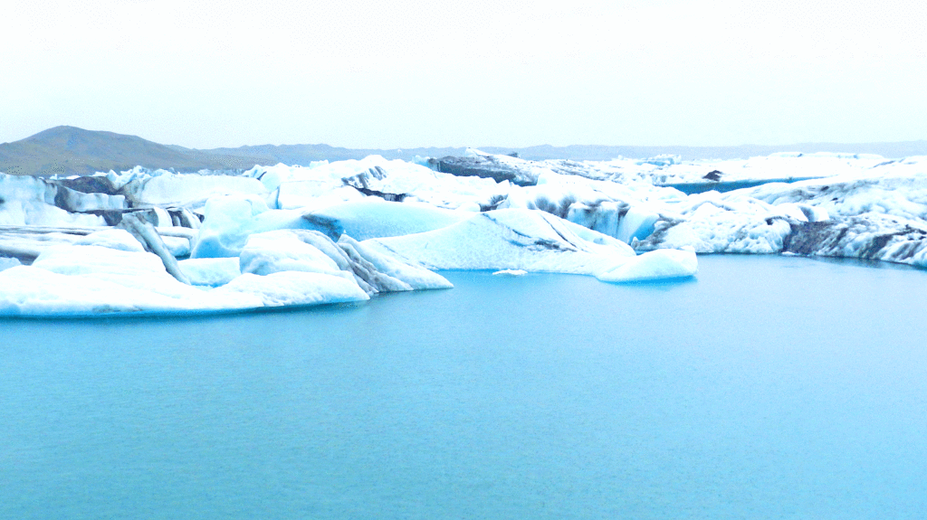
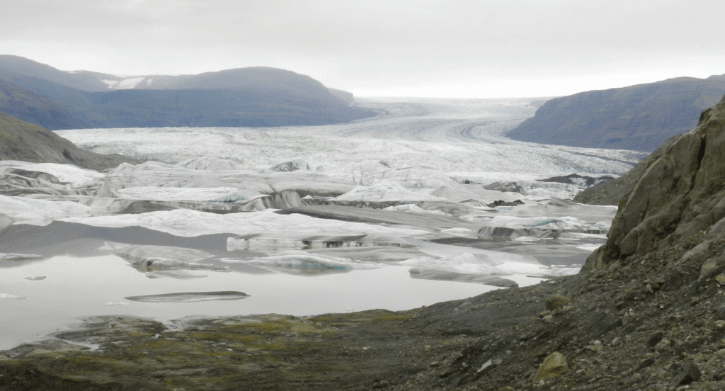
The vast majority of the glacier is in the highlands extending north from the coast, but it does descend almost to the ocean at a couple of points. At Jökulsárlón there is a glacial lagoon that has been growing for a few decades as the result of glacial melting. https://en.wikipedia.org/wiki/J%C3%B6kuls%C3%A1rl%C3%B3n Our stop there was rendered brief by a cold, driving rainstorm but we were able to get a couple of pictures at least.
Jökulsárlón
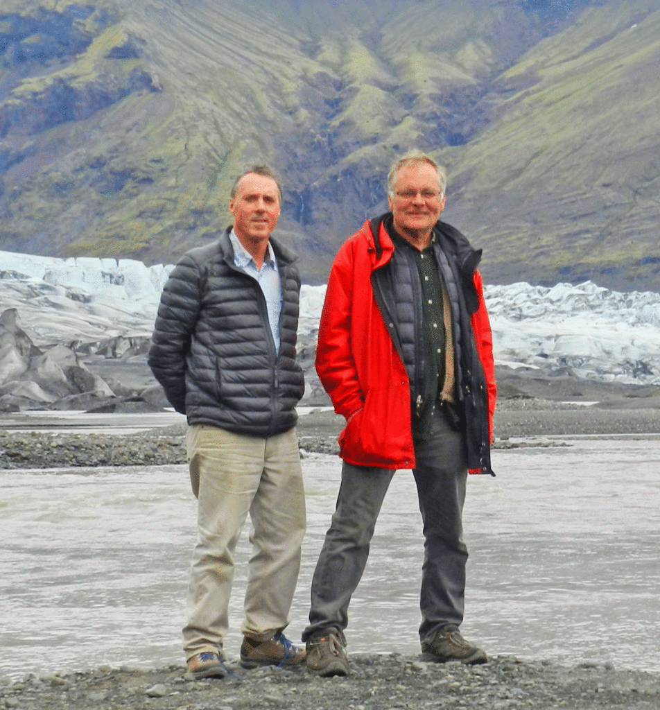
The Park’s main visitor centre and campground is at Skaftafell. By the time we got there the weather was better and we were able to do a short trail up to the glacier itself.
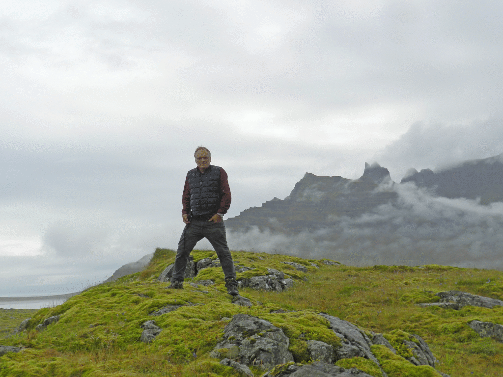
Stephen and I at Vatnajokull near Skaftafell
We opted not to stay at the Skaftafell campground because it was, as we had expected, quite crowded. Instead we continued west to a private, very well-run campground. There we met a Brit in a Defender that had come down from Landmannlauger, the highland hiking area which was our next destination. He made a very enthusiastic recommendation of an F-Road going in to Landmannlauger, the F-208. He said it had many water crossing but nothing a Defender could not handle. This proved to be one of the nicest overland routes I did in Iceland (not the nicest – that distinction belongs to the Thorsmork trip that I did later with Laura). Landmannlauger is the subject of the next post.
From Eglisstadir we headed south to an area known for the long finger like penninsulas that create deep fjords. With the exception of one recently-created short-cut the R1 route follows the ocean in and out of each fjord. Lots of distance, but the landscape is fantastically beautiful. More mountainous and rockier than the north, with scree littering the steep slopes. I told Stephen he and I should agree not to show any of our photos to Maurice. For this leg of the trip the weather was also very good. A bit cool but sunny enough that the colour of the green moss landscape really shone through.
Stephen in the Eastern Fjords
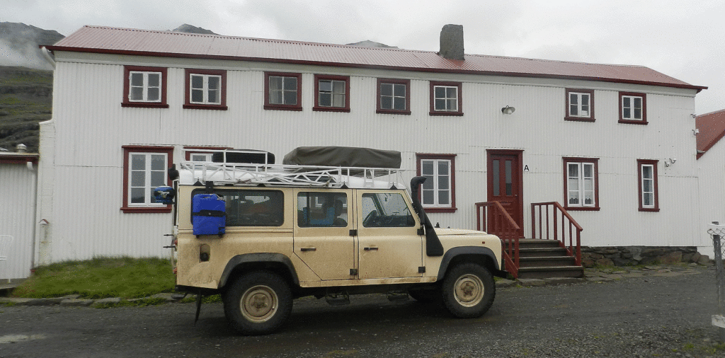
Our destination that night was Berunes Farm. Situated on one of the fjords it advertised an inn and campground and marked the approximate halfway point between Eglisstadir and the Skaftafell National Park https://www.east.is/en/what-to-see-and-do/services/berunes-hi-hostel
Berunes Farm
The campground was not spectacular, just a soggy field surrounded by a few bushes, but the location up from the fjord was lovely, and they had a cozy bar in one of the buildings on site. We cooked our own dinner and then retreated to the bar for a nightcap. The spot next to us in the camping field was occupied by a small camper truck that had been rented by 3 Australian women – Stephen and I could not at all figure out how the three of them all fit to sleep inside the camper. They were travelling in the opposite direction than we were and were able to foreshadow the Vatnojokull glacier that lay ahead of us, complete with stories of how they had taken some ice to use in their vodka.
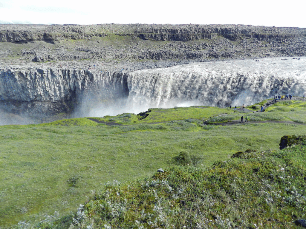
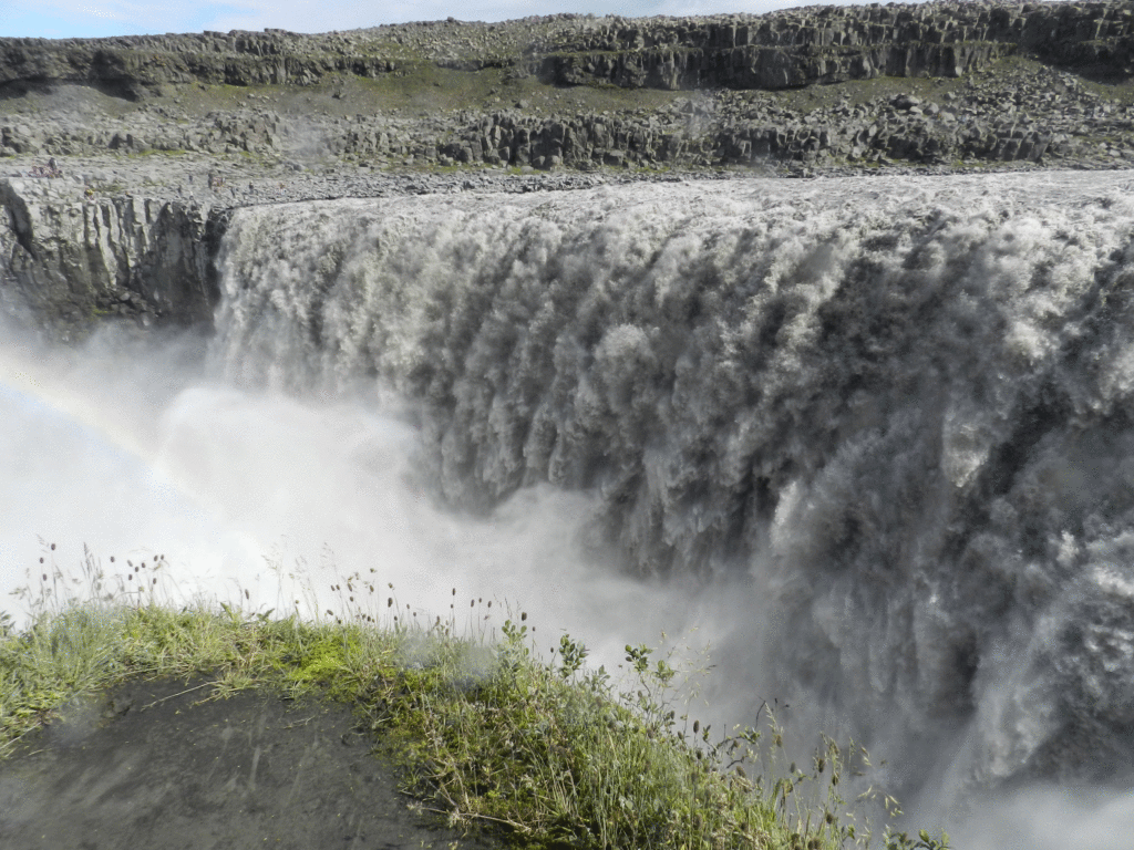
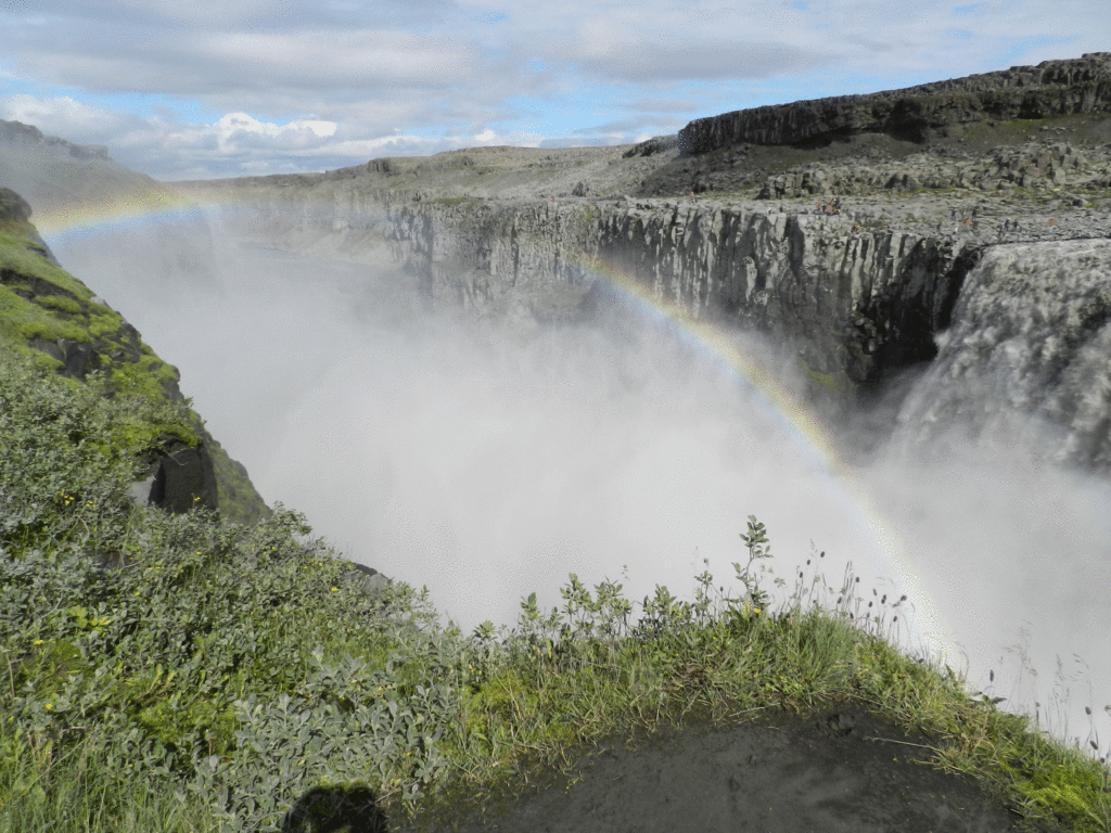
Aspyrgi is a national park located in northern Iceland east of Lake Myvatn. It is actually the northern section of Vatnajökull National Park that runs from the glacier of the same name in the south almost all the way across the country. It is also the location of Dettifoss waterfall, the most powerful in Europe.
Dettifoss wasabsolutelyawe-inspiring
From Dettifoss we continued north to to find the campground in Aspyrgi Park. This one was lovely, much more reminiscent of Canadian campgrounds with lots of trees. It was as natural and uncrowded as any campground I had been in Iceland to that point (although later in the trip I visited others that were also very good). We arrived at the end of a long holdiday weekend and there were were lots of Icelandic families about. It was still staying light until close to midnight at that point and and we fell asleep listening to the sounds of children cavourting on the play structures well into the night. We decided to stay in Aspyrgi a second night to be able to enjoy some hiking in the area. When we returned to the campground the second night after our hike there were two significant changes: there were few other campers as the weekend was over and all the Icelanders had gone back to work; and the weather had taken quite a turn for the worst, with temperatures near 5 deg. Cel. and lots of wind and rain.
This was a really tough point in the trip, we were completely bowed by the cold, wet weather and the
When the going gets tough…..with some camping staples at Aspyrgi
morning of our second day at Aspyrgi was miserable. It had rained all night and it was still only about 5 degrees C. We both recognized we were at the end of our camping tether and that we would need to seek proper shelter. Everything we had was wet; fortunately the washroom building in the campground had an amazing “dryer” comprised of a big closet with a couple of blowers that circulated warm air through the multi-layered hanging system. We used that system, which I had never seen before, to dry not only our sleeping bags and clothes, but also the Eureka tent that Maurice was using.
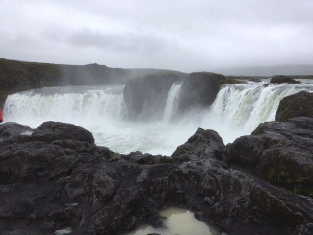
After packing up we drove straight to Husavik, a town in a nearby bay known for great whalewatching but we were not in the market for whalewatching, we just wanted to get warm. We went to the first hotel we could find only to learn that it was full, but the receptionist took pity on us (we were pretty pitiful at that point) and referred us to a friend who operated a guesthouse. It turned out to be a great spot. A large, quite recently constructed house with several sleeping rooms and a large, well-equipped shared kitchen. Maurice and I arrived mid-afternoon (it was still raining hard) before anyone else and had the run of the kitchen. We used just about every burner on the stove to create a wonderful dinner that featured a great lamb stew. After a couple of weeks of camping in occasionally very adverse conditions it was a luxury to enjoy ourselves out of the cold wind and rain. I really needed that. We were now approaching the end of Maurice’s explorations of Iceland, as he had to catch his plane out of Akureyri in a couple of days. On our way back to Akureyri we stopped at another incredible waterfall, Godafoss.
Godafoss
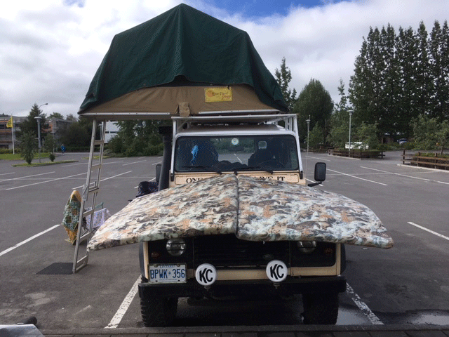
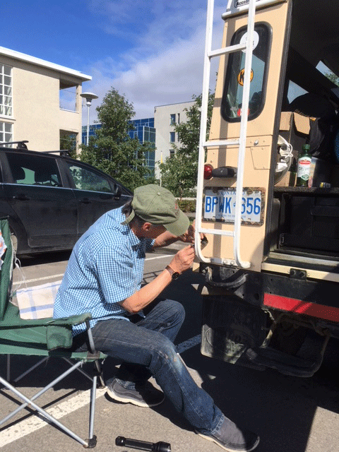
When we got to Akureyri the weather was still iffy enough and we were still not quite fully recovered from our last camping outing so we decided to pass on the campground we had used on the way out and instead went to a real hotel. The Hotel Edda is an Icelandic chain of simple, yet very clean and comfortable dorm style accommodations that grew out of a practice that developed in Iceland in the 1950s of converting student dorms to summer accommodation for the then emerging domestic tourist industry. www.https://www.hoteledda.is/en/hotels/hotel-edda-akureyri Of course no sooner had we settled in and the weather immediately improved, which allowed us to spend our last free day before Maurice left drying out our gear, specifically the rooftop tent and mattress, and doing some small repairs on the Defender.
Airing out tent and mattress in the Akureyri Edda hotel parking lot (maybe I could adapt this to reduce the Defender engine noise 😉 A rusted signal light needed a fussy ‘McGyvor’ fix. Note the blue sky and short sleeves
It was tough bidding farewell to Maurice, who had been there from the very beginning to help get everything organized and ready to go. Now I would be on my own for a few days as I continued to make my way east towards Eglisstadir to pick up Stephen, the next joiner.
The eighteen months of our Land Rover restoration project brought us into contact with many people who in their own way contributed to the successful outcome. We met mechanics and electricians, welders and painters, upholsterers and air conditioning specialists. After returning from our trip one of our last Saturday afternoons in Ghana before departing for Canada was spent saying thanks to many of those individuals by inviting them to Opere’s shop for pizza and beer. We set up the Defender in full campsite mode, filled the fridge with beer and soft drinks and brought some pizza from Frankies and meat pies we bought from Rejoice at the High Commission.
The turn out was not bad, if devoid of female presence. Despite that, on request we put an Ebo Taylor CD in the stereo and the boys even danced.
It was our way of saying thank you and farewell to some people who helped realize a project that was, when you think about it, rather unlikely and against the odds.
This is a very delayed post, sent almost three weeks after we returned to Accra and concluded our overland trip.
Here is a summary of our overland trip in a 17 year old Land Rover Defender, quantitatively speaking:
Countries visited 4
Kilometres driven 5,500
Km on unpaved roads, ranging from reasonably good laterite to downright poor donkey track: About 1,000
Oil consumed ½ litre
Breakdowns: 0
Number of times stuck: 0
Maintenance stops 3
Flat tires: 1
Nights: 30
Nights camped in organized establishments 17
Nights bush camping 4
Number of campsites 16
Nights in hotels: 9
Number of hotels 5
Per night Cost of Camping $10
Per night cost of hotels $80
Most expensive night: $110
Least expensive night: $0
Days of rain: 3
Restaurant meals: 20
Camp/Picnic Meals 70
Border crossings: 6
Currencies: 2
Blog posts published 25 (including this one)
Guides Hired: 11
And this is where we went:
Our counter clockwise route from Accra, Ghana, into Togo and Benin, back into Togo from northrn Benin, returning to Benin, on to Burkina Faso and back into northern Ghana descending to Accra. Red x”s indicate stopover points.
After leaving Bolgatanga our drive down through northern Ghana was a return to the somewhat familiar. We arrived in Tamale, capital of the Northern Region, about 15:00, in time to go by the CIDA Program Support Unit (CIDA-PSU) office there. Tamale is a pleasant city, clean with wide street and good infrastructure. For Jonathon this was to a certain extent a return to work. We were on holiday but being there he was pleased to engage in work-related discussions with Iddrissu and others in the PSU, not a bad way to get caught up after more than a month on the road incommunicado. We have been to Tamale before, Jonathon for work many times, and always stayed at the Marian Hotel, but this time we were looking for something a bit less refined. On the advice of CIDA-PSU colleagues we went to the Ghana Institute of Linguistics Guest House where the manager agreed to let us set up Camp Defender in their lovely garden.
Northern Ghana is where Ghana sheanut is grown, from which many beauty products are derived. The cultivation of the trees and the processing of the nuts is principally a female activity, and the source of income for many women who work independently or in co-operatives. While in Tamale we were able to stop in at one for tour and purchase some of the sheanut “butter” which is great skin lotion. A lot of this is exported, and can be found on the shelves at the Body Shop in malls in North America.
Woman Drying Her Shea Nut in a co-operative processing centre
Most significantly is was while we were in Tamale that Ghana’s President Mills died unexpectedly, we learned of it while we were in an internet cafe and may have seen it before most of the rest of the city.
The other item worth mentioning was meeting up with Abu, the Director of Northern Region office of Ghana’s Environmental Protection Agency (EPA). Jonathon and Abu know each other through the CIDA-EPA partnership and on this visit they had lots of fun sparring about the Land Rover. As those of you who followed the restoration stage of this blog may know, for the first 15 years of its life our Defender was an EPA vehicle, and as an EPA veteran Abu spent many miles driving it around the extremely rough tracks of northern Ghana to support village environmental education. Abu was very sceptical that this was indeed the same vehicle, it was only when he saw the original GR 1995 license number that they had etched in all the windows that he accepted it was indeed the same vehicle they had driven so hard for so long, and evenatually sold at auction for scrap. Abu said EPA wanted to buy it back now; Jonathon said it was not for sale.
Jonathon and Abu sparring about the old EPA Land Rover
After an unofficial CIDA work-related meeting with the PSU and EPA (Jonathon forgot he was on holiday) we had a much later than planned departure out of Tamale. We knew we would not be able to make it as far as Kumasi, Ghana’s second largest city and a milestone en route to Accra, before dark. The back-up plan was to pull up at a monkey sanctuary about 100 km north of Kumasi a ways off the main road.
A couple of hundred kilometres to the south-west of Tamale is Mole National Park, the place to go in Ghana to see elephants. Although we did not go there on this trip, we could have, and because it is such a great part of the Northern Ghana experience we are going to cheat a bit here and close this post with a couple of pictures from a visit we made there last year.
As we made our way toward Tamale from Sirigu the main stop of interest was Bolgatana, capital of Ghana’s Upper East Region. Bolga is known for it very unique and attractive baskets, which are arguably the most attractive craft produced in Ghana, and useful to boot. One can find these in Accra, but there is something satisfying about going to the source. We were also in the market for a few of these baskets for a design idea for our Ottawa house.
One source is a craft market on the outskirts of Bolga, but there is also a place referred to as the basket market, which is less of a market than a dark, unenhanced room with baskets piled in it. We went to both but it was the latter that had much more greater choice and higher quality for what we were looking for. Laura went wild.
Basket Case?
Bolgatanga also has to be counted as a maintenance stop. While Laura was basket shopping I went to deal with the slow leak in the right rear tire, which was actually not so slow anymore and had gone completely flat while we were in Sirigu. The affable roadside tire guy I chose was quite amused by the hardware he pulled from inside our tire: a 2″ inch nail AND a 3″ bolt!
We finally used that spare tire that graced the bonnet through 3 countries
Our last night in Burkina was spent bush camping near a National Park called Ranch Nazinga, a popular site for elephant viewing. The late afternoon was another off-road excursion down a mud track to try to get into a campement that was located some 5 kms off the main road. There had been a great deal of rain the previous night and day and we had to traverse some wide stretches of water.
for about 20 minutes until we arrived at the Nazinga River, which normally one just drives through. However, it had swollen its banks and was about 100 yards wide where the track went in. I waded in to check the depth, egged on by an audience of local teenagers who kept saying “ca peut aller” (it can go). Clearly for them this was a spectator sport.
Wading in to assess crossability. It may not be clear here, but that is water as far ahead as you can see, and more water off to the right
One of the older boys said “il y a un trou” (there is a hole) and that there was another route upriver where they had put in some boards to help the crossing. If we had had a couple more hours of daylight I might have tried it but there was quite a current and it was getting late so we decided that discretion was the better part of valour, swallowed our pride and turned around, much to the chagrin of the boys. The fact was that we were just looking for a place to camp for the night and there was no reason for us to risk having the Landy swept downriver. We retraced our route through down the wet track and found a nice place to camp on higher ground to pass a very pleasant night.
At Nazinga we were only about 40 kms from the border, but before we left Burkina we took a detour east to the village of Tiebele where the Gournonsi practice of decorating the outside of the mud houses with painted geometric patterns is still evident. Despite the poverty Tiebele almost felt touristy as we were flagged by prospective guides. There is no system for assigning guides, you get the one that you decide to stop for, but once you have chosen one it seem the rest leave you alone.
We were taken to a complex of mud houses that are apparently the residence of the Chief and his family, the guide said some 80 people lives within the walls. It was a bit more refined than houses we have seen elswhere with some very unique features.
Mom and child in compound – note the Y branch roof ladders
We did get a sense that maybe this was more of a museum than an actual house, it seemed too neat and clean. There were some people around, and women on the roofs stirring grains as they dried in the sunshine, but the place felt like it might be more a place to show the tourists than an actual chief’s compound. However that did not detract from the very unique structure, which had many features we had not seen in other villages we have visited.
We could see plenty of other similar structures around, it is much less disruptive that they have one they can take the tourists to without disturbing people. That is just good community tourism management. In the Tata Somba houses we went to in Benin and Togo we had to pay a tip to people whose houses we visited, which was a bit awkward.
On our way out of Tiebele we stopped at the local pump to fill up our 20 litre wash water jerry can. We paid the Village Water Committee 200 CFA (50 cents) for the water, and another 200 CFA 50 to the fellow who lugged the full water can back to the vehicle.
Our objective that night was Sirigu in Ghana,which is about 60 km from Tiebele by road through the border crossing but probably only about half that as the crow flies. We spent the last of our CFA on diesel at the last filling station in Burkina at Po before we crossed the border. Then after crossing the border, just as we were clearing Customs on the Ghana side, the last of all the check points on both sides of the border, we realized that the filling station we had stopped at in Po an hour earlier had not put the gas cap back on. As it is a locking tank it meant a full set of our keys was also still in Burkina Faso. Fortunately, officials in both countries were prepared to pretend we were still in Ghana while we quickly drove back to Po to pick up the keys and cap and waved us back through when we came back 20 minutes later. I don’t think they would do that at the US-Canada border, but then they probably would not have forgotten to put the gas cap back on either.
We arrived in Sirigu about 5 PM, about 20 km in down a laterite road from the highway. En route via the laterite side road we were pulled over by a Ghana Immigration crew that were clearly driven by pecuniary motives, and were none too pleasant about it. They asked why were going to Sirigu and laughed when we said we were going to visit the Women’s Co-op. “Ohhh, going for a visit are you?” It was almost funny to see their reaction when they realized that we had diplomatic passports and the Land Rover they had surrounded to hassle had diplomatic plates. They apologized profusely for bothering us and let us move on, but left us with an impression that the Ghana Immigration Service is not the most professional of organizations.
Sirigu and the surrounding region is also known for decorative painting of the houses. There is a strong women’s co-operative in Sirigu that runs workshops and a guest house with a lovely grounds where we were able to camp for the night. There was a Dutch man staying there who had taken workshops in pottery and basket-making, and an American woman doing research in the region for her Masters thesis in Art History. A pump on the grounds was visited by a steady stream of locals, mostly children, picking up water. As the co-op facilities are themselves painted in the local style we did not have to go anywhere to see it up close.
Laura on a Sirigu Roof, mimicking the cover of the 2009 Bradt Guide to Ghana
The Craft Shop at Sirigu Women’s Co-operative
Sirigu more modern and refined than what we saw in Tiebele, but does not convey the historical sense. We visited the co-op shop in the morning and were on our way to Bolgatanga by 10:00 AM.
PS. A systems note: We have now put on more than 5,000 km on the Defender in the month we have been on the road. Everything is working well. The early charging problems we had with the second battery have disappeared and there is no longer any loss of coolant. Incredibly, there is also no appreciable oil consumption – we have used less than a half litre of since we left Accra. Even the air conditioning, for which I thought it was only a matter of time before something failed, is performing perfectly. We did discover an interesting electrical glitch related to the faulty hazard light switch that is the stuff Land Rover folklore is made of. I had discovered sometime before we left Accra that if I turned the ignition off when the flashers were on the motor keeps running. It was explained to me by Eric our electrician that the hazard switch overides other systems and that this can happen if the switch is faulty. Replacing said switch did not make the cut when determinng the priority things to do before we left. We discovered a new twist on the switch problem one day near Sindou when our stereo suddenly stopped working. I thought it was simply a fuse and on inspection found that indeed there was a fuse that was blown that could have been the problem. We were still looking for a place in Banfora to buy a fuse from when we put the flasher on to turn around and the stereo suddenly started working again. We subsequently learned it was just a matter of playing with the hazard switch until the radio comes on, then it stays on, at least until we go into reverse gear, which for some bizarre reason knocks the stereo off again. I am not making this up. Apart from that rather humorous glitch, and a slow leak in a rear tire that needs attention, everything is humming.
On our drive west from Bobo- Dialaisso to Banfora we stopped to take a picture of a particularly green valley below and it was only in the process of framing the picture that we noticed a waterfall tumbling across a field not 100 metres from where we were parked. What a great picnic spot!
Our destination that day was Sindou, site of the most amazing natural landscape. We did a bit of an unplanned detour toward Cote d’Ivoire because on our map it appears to be straight through the town of Banfora and, unbelievably, the dirt track turn-off for Sindou in the town of Banfora is not markedl. Great road, but the mille bournes (milestones – a legacy of the French colonial system) all kept counting down the distance to the border town of Koloka, which was not on our route. We caught this after about 10 km and turned around to go back to Banfora. The correct road was only dirt, but it was much more attractive than the highway.
The Sindou Peaks are quite special. Created by limestone rocks on one side of a very fertile valley that have been eroded into narrow stalactite-type structures. The guidebooks all refer to landscape as reminiscent off “Planet of the Apes” although somehow that does not quite seem appropriate.
Walking tours of the area are provided by the Association Senoufa, a local community development group that uses the proceeds to help pay for childrens’ school fees. One can get tours that range from 1 hour to more than a week and involve hiking back to Bob0-Dialasso, the distance we had driven over two short days. We took the two hour option and that allowed us to hike to the upper plateau and get a great view.
Sindou Peaks as seen across the valley from our tent window
There was a special bonus to our visit to Sindou, in the form of what has to be one of the best campsites in the world, at least the best we had on our trip. We had been told about a campement in Douna, a town 10 km shy of Sindou, by Alain, the French owner of the B&B we stayed at in Ouga. He did not rave about it, he just mentioned it, but we decided to have a look because it was getting late afternoon and it was before Sindou. We are very glad we did. As a campement it had also had rooms, but they were just very basic huts that were not really even furnished. But as a campsite for us it was perfect.


")


